

Bus 13 in Edinburgh links Craigleith Retail Park and Lochend Avenue. The route is 13.1 km long with 48 stops, and the official schedule from Lothian Buses puts the full trip at about 57 minutes. On a weekday it runs 12 trips in one direction.
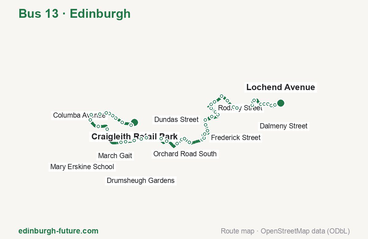
Route at a glance
| Mode | Bus |
|---|---|
| Route number | 13 |
| City | Edinburgh |
| Operator | Lothian Buses |
| Start → end | Craigleith Retail Park → Lochend Avenue |
| End → start | Lochend Avenue → Craigleith Retail Park |
| Route length | 13.1 km / 13.4 km in the opposite direction |
| Number of stops | 48 / 47 in the opposite direction |
| Travel time | about 57 minutes |
| Trips per day | 12 on weekdays one way |
| Frequency | peak 60–75 · midday 60–70 |
| First / last trip from «Craigleith Retail Park» | 06:35 / 18:33 |
| First / last trip from «Lochend Avenue» | 06:40 / 18:35 |
| Fare | 2.40 £ (fare in effect since 22 February 2026) |
| Updated | August 22, 2026 |
Route of Bus 13
Outbound: Craigleith Retail Park → Lochend Avenue
This direction has 48 stops and runs 13.1 km. The route passes Craigleith Road, Mary Erskine School, Princes Street (west), Beaverhall Road. Below is the full list with the distance from the first stop.
| No. | Stop | From start | Note |
|---|---|---|---|
| 1 | Craigleith Retail Park | 0.0 km | Terminus |
| 2 | Craigleith Road | 0.2 km | |
| 3 | Maidencraig Crescent | 0.6 km | |
| 4 | St Columba’s Church | 0.8 km | |
| 5 | Columba Avenue | 1.0 km | |
| 6 | Telford Road | 1.1 km | |
| 7 | Strachan Road | 1.3 km | |
| 8 | Hillpack Way | 1.6 km | |
| 9 | March Gait | 1.9 km | |
| 10 | Hillpark Green | 2.2 km | |
| 11 | Craigcrook Castle | 2.6 km | |
| 12 | Ravelston Dykes Road | 3.0 km | |
| 13 | Mary Erskine School | 3.9 km | |
| 14 | Craigleith Rise | 4.1 km | |
| 15 | Craigleith Crescent | 4.4 km | |
| 16 | Garscube Terrace | 4.7 km | |
| 17 | Orchard Road South | 4.9 km | |
| 18 | Gallery of Modern Art | 5.5 km | |
| 19 | Belford Bridge | 5.8 km | |
| 20 | Chester Street | 6.3 km | |
| 21 | Drumsheugh Gardens | 6.6 km | |
| 22 | Drumsheugh Place | 6.7 km | |
| 23 | Queensferry Street | 6.9 km | |
| 24 | Princes Street (west) | 7.4 km | |
| 25 | Frederick Street | 7.5 km | |
| 26 | George Street (Assembly Rooms) | 7.8 km | |
| 27 | Thistle Street | 8.0 km | |
| 28 | Abercromby Place | 8.2 km | |
| 29 | Dundas Street | 8.4 km | |
| 30 | Drummond Place | 8.7 km | |
| 31 | Mansfield Place | 9.1 km | |
| 32 | Bellevue Crescent | 9.2 km | |
| 33 | Rodney Street | 9.4 km | |
| 34 | Logie Green Road | 9.6 km | |
| 35 | Beaverhall Road | 9.8 km | |
| 36 | Broughton Primary | 10.2 km | |
| 37 | McDonald Street | 10.4 km | |
| 38 | Hopetoun Crescent | 10.8 km | |
| 39 | Shrubhill | 11.0 km | |
| 40 | Albert Street | 11.7 km | |
| 41 | Dalmeny Street | 11.8 km | |
| 42 | St Clair Place | 11.9 km | |
| 43 | Albion Place | 12.2 km | |
| 44 | Hawkhill Avenue | 12.4 km | |
| 45 | Lochend Road | 12.5 km | |
| 46 | Lochend Park | 12.7 km | |
| 47 | Hawkhill | 12.8 km | |
| 48 | Lochend Avenue | 13.1 km | Terminus |
Inbound: Lochend Avenue → Craigleith Retail Park
This direction has 47 stops and runs 13.4 km. The route passes Sleigh Drive, Broughton Primary, Princes Street (west), Craigleith Rise. Below is the full list with the distance from the first stop.
| No. | Stop | From start | Note |
|---|---|---|---|
| 1 | Lochend Avenue | 0.0 km | Terminus |
| 2 | Sleigh Drive | 0.3 km | |
| 3 | Lochend Road | 0.8 km | |
| 4 | Hawkhill Avenue | 1.0 km | |
| 5 | Albion Place | 1.2 km | |
| 6 | St Clair Place | 1.5 km | |
| 7 | Dickson Street | 1.6 km | |
| 8 | Buchanan Street | 1.8 km | |
| 9 | Pilrig Street | 2.0 km | |
| 10 | Shrubhill | 2.3 km | |
| 11 | Hopetoun Crescent | 2.5 km | |
| 12 | McDonald Street | 2.8 km | |
| 13 | Broughton Primary | 3.2 km | |
| 14 | Beaverhall Road | 3.4 km | |
| 15 | Logie Green Road | 3.5 km | |
| 16 | Rodney Street | 3.9 km | |
| 17 | Mansfield Place | 4.2 km | |
| 18 | Drummond Place | 4.6 km | |
| 19 | Dundas Street | 4.9 km | |
| 20 | Abercromby Place | 5.1 km | |
| 21 | Thistle Street | 5.3 km | |
| 22 | George Street (Assembly Rooms) | 5.6 km | |
| 23 | Frederick Street | 5.7 km | |
| 24 | Princes Street (west) | 5.9 km | |
| 25 | Queensferry Street | 6.5 km | |
| 26 | Drumsheugh Place | 6.7 km | |
| 27 | Drumsheugh Gardens | 6.8 km | |
| 28 | Chester Street | 7.0 km | |
| 29 | Palmerston Place | 7.3 km | |
| 30 | Belford Bridge | 7.6 km | |
| 31 | Gallery of Modern Art | 7.8 km | |
| 32 | Ravelston Park | 8.2 km | |
| 33 | Orchard Road South | 8.4 km | |
| 34 | Craigleith Crescent | 9.1 km | |
| 35 | Craigleith Rise | 9.3 km | |
| 36 | Mary Erskine school | 9.4 km | |
| 37 | Ravelston Dykes Road | 10.3 km | |
| 38 | Craigcrook Castle | 10.8 km | |
| 39 | Hillpark Green | 11.2 km | |
| 40 | March Gait | 11.5 km | |
| 41 | Hillpark Way | 11.8 km | |
| 42 | Strachan Road | 12.0 km | |
| 43 | Telford Road | 12.2 km | |
| 44 | Columba Avenue | 12.4 km | |
| 45 | St Columba’s Church | 12.6 km | |
| 46 | Craigleith Road | 13.1 km | |
| 47 | Craigleith Retail Park | 13.4 km | Terminus |
Schedule and frequency
According to the official schedule from Lothian Buses, the route runs 12 trips in one direction on a weekday.
| Direction | Weekdays | Weekends and holidays |
|---|---|---|
| From «Craigleith Retail Park» | 06:35 — 18:33 | — — — |
| From «Lochend Avenue» | 06:40 — 18:35 | — — — |
Frequency calculated from the departure table: in the morning peak buses run every 60–75 minutes, most often every 65; midday every 60–70 minutes; in the afternoon peak every 68.
Fare and payment
A single ride costs 2.40 £ — fare in effect since 22 February 2026. The same fare applies to Lothian buses in Edinburgh.
A single bus journey costs £2.40 and covers one journey only — it gives no transfer and is not valid on Edinburgh Trams. A City DAYticket is £6.00 and works on both bus and tram; contactless travel is capped at £5.70 a day.
Frequently asked questions
How much does a ride on bus 13 cost?
2.40 £ for a single ride — fare in effect since 22 February 2026.
When do the first and last trips run?
From Craigleith Retail Park the first is at 06:35 and the last at 18:33. From Lochend Avenue they are 06:40 and 18:35.
How long does the trip from Craigleith Retail Park to Lochend Avenue take?
About 57 minutes end to end — the median of full trips in the official schedule.
How many stops does the route have?
48 outbound and 47 inbound according to the official GTFS feed. The two lists do not match exactly.
Does bus 13 run on weekends?
Yes, the route runs every day, with a separate weekend schedule.
Every route number with its termini, operating hours and travel time is collected in the Edinburgh buses overview.
Data current as of August 22, 2026. Schedule and termini — Lothian Buses. Fares — Lothian Buses. Stop list, schedule and route geometry come from the official GTFS feed (Bus Open Data Service (BODS)).